Lab. of Image Data Science
News
LIDS have attended the IGARSS 2018
The Ph.D. candidate, John Vargas, have presented his work entitled "Correcting Misaligned Rural Building Annotations in Open Street Map Using Convolutional Neural Networks Evidence" at International Geoscience and Remote Sensing Symposium (IGARSS) in Valencia, Spain.
The conference is a premier event in remote sensing and provides an ideal forum for obtaining up-to-date information about the latest developments, exchanging ideas, identifying future trends, and making networking with the international geoscience and remote sensing community.
The presented work consists of a Markov Random Field (MRF) method to correct misaligned rural building annotations, since mapping rural buildings in developing countries is crucial to monitor and plan in those vulnerable areas.
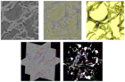
See some pictures below:
Latest News See all
-
 June 28, 2022 19:16
IC LIDS receives INOVA Inventors Award
-
 February 26, 2020 20:31
Best Student Paper Award at BIOSTEC 2020
-
 March 05, 2020 16:39
DAPI is presented to the International Medical Community