Lab. of Image Data Science
Projects
Interactive Annotation of Remote Sensing Images
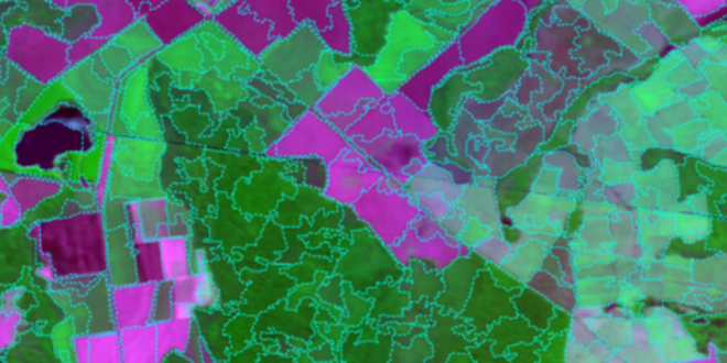
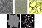
Remote sensing image classification is a challenging and basic task to verify land cover and plan land use. Our strategy has been to segment the image into superpixels for contextual characterization, data organization, and active learning. Given the large size of remote sensing images for expert supervision, we have developed efficient user interaction mechanisms for active learning in order to design a classifier with minimum effort and time of the specialist. In addition to the development and validation of the methods by real specialists (i.e., with no simulation of their actions), we aim at a realistic solution by also treating non-interest regions for image annotation.
Team:
Alexandre Xavier FalcãoDevis Tuia
Jeferson Alex dos Santos
John Edgar Vargas
Latest News See all
-
 June 28, 2022 19:16
IC LIDS receives INOVA Inventors Award
-
 February 26, 2020 20:31
Best Student Paper Award at BIOSTEC 2020
-
 March 05, 2020 16:39
DAPI is presented to the International Medical Community